How a Strong 2026 El Niño Could Affect Your Winter
Winter is still months away, but weather events happening thousands of miles out in the Pacific Ocean is already shaping expectations for rain, shine, snow, sleet, and temperatures across the United States.
It’s called El Niño, and the 2026 edition is intensifying. The name gets tossed around a lot whenever unusual winter weather is expected; however, the overall mechanics are straightforward and worth knowing, the better to understand what is happening that will so impact our winter.
The NOAA Climate Prediction Center says El Niño is strengthening; there is over a 90% chance it will become a very strong event this autumn and winter. Forecasters put the odds at 69% that El Niño becomes historically strong between October and December.
That does not tell us exactly what the weather will do in any particular town. El Niño changes the odds of certain weather patterns; it does not dictate every storm, cold snap, or sunny weekend. Here is what it can tell us, however.
So, What Exactly is El Niño?
Embedded media follows. Please allow a moment for it to load.
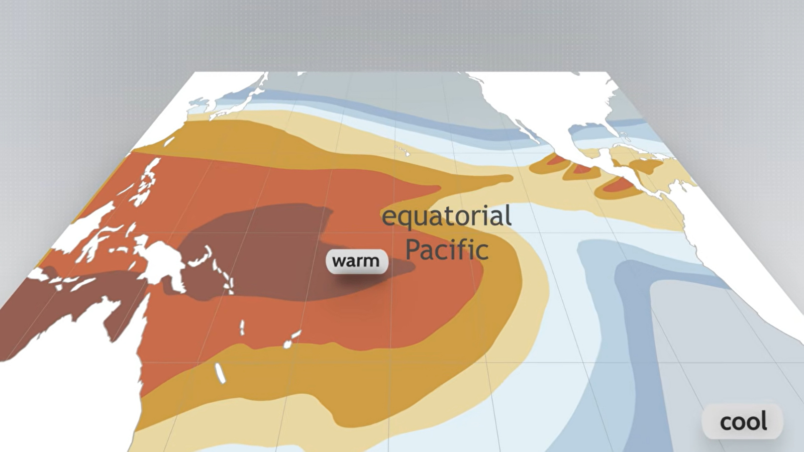
Traditionally, steady winds blow across the tropical Pacific and help push warm surface water toward Asia. During El Niño, those winds weaken, and unusually warm water spreads farther east across the central and eastern Pacific, according to NOAA Climate.gov.
That warmer ocean changes where huge areas of warm, moist air rise and where tropical thunderstorms develop. The shift can then affect air circulation much farther away—including over North America.
One of the biggest changes involves the jet stream, a fast-moving strip of air high in the atmosphere that helps steer storms across the country. NOAA Climate.gov explains that El Niño usually strengthens and shifts part of the winter jet stream farther south, helping send more storms across the southern United States.
However, NOAA stresses that even a very strong El Niño does not guarantee its usual effects everywhere.
What Could That Mean for This Winter?
The clearest pattern right now is a wetter southern half of the country, plus warmer-than-normal temperatures across much of the northern U.S. NOAA’s seasonal outlook published on Aug. 20 increasingly favors above-normal precipitation across California, the southern U.S., and parts of the East Coast as winter progresses. It also anticipates warmer-than-normal temperatures from the Pacific Northwest toward the Northeast.
For California and parts of the South, that may mean more rainy winter stretches, as opposed to the consistently mild, dry weather some travelers might normally expect. Anyone living in an area prone to heavy rain may also want to make ordinary preparations such as clearing gutters and drains; FEMA recommends those steps as part of preparing property for flooding.
Snow is a more complicated topic because precipitation needs cold enough air to fall as snow. Historical El Niño patterns analyzed by NOAA Climate.gov indicate increased snowfall in some higher elevations across the southern half of the country. Meanwhile, the Pacific Northwest, northern Rockies, Great Lakes, and parts of New England typically see less. The Weather Channel says the Sierra Nevada and Colorado could be better positioned for snow this season, while Utah remains harder to predict.
Planning a winter trip or outdoor adventure? Seasonal prediction overviews describe general trends months in advance. As a result, the National Weather Service recommends watching shorter-range forecasts the trip date gets closer and closer, so it’s more within a range when meteorologists can say with more certainty if an actual storm will affect your wintry—or not-so-wintry—getaway.